File:Nelson river basin map.png
From WikiAlpha
Size of this preview: 800 × 565 pixels. Other resolutions: 320 × 226 pixels | 1,200 × 848 pixels.
Original file (1,200 × 848 pixels, file size: 1.72 MB, MIME type: image/png)
From https://commons.wikimedia.org/wiki/File:Nelson_river_basin_map.png
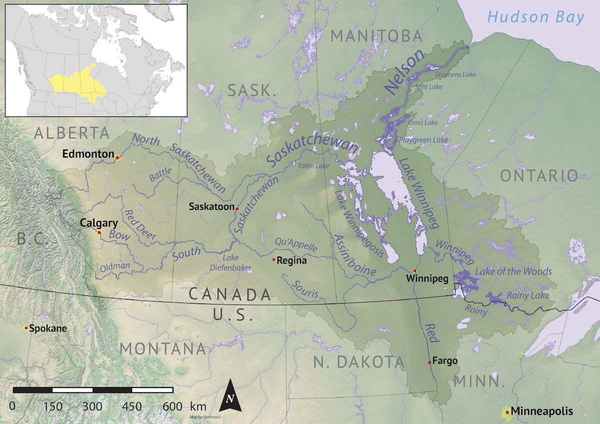
Original caption: Map of the Nelson River drainage basin. Data derived from NASA SRTM, Statistics Canada, US Geological Survey, Natural Earth, all public domain.
Wikipedia contributor Shannon1 released this image under GNU Free Documentation License, Version 1.2 or any later version on 2019-10-30
File history
Click on a date/time to view the file as it appeared at that time.
| Date/Time | Thumbnail | Dimensions | User | Comment | |
|---|---|---|---|---|---|
| current | 11:37, 31 May 2023 | | 1,200 × 848 (1.72 MB) | Geo Swan (Talk | contribs) | From https://commons.wikimedia.org/wiki/File:Nelson_river_basin_map.png '''Original caption:''' Map of the Nelson River drainage basin. Data derived from NASA SRTM, Statistics Canada, US Geological Survey, Natural Earth, all public domain. Wikipedia... |
- You cannot overwrite this file.
File usage
The following page links to this file: