File:Chippewa and Stanley Low Levels (Larsen 1987).jpg
From WikiAlpha
Revision as of 21:02, 24 November 2019 by Geo Swan (Talk | contribs) (This map was the work of wikimedia contributor [https://commons.wikimedia.org/wiki/User:Chris_Light Chris Light] who released it under the [https://creativecommons.org/licenses/by-sa/3.0/deed.en Creative Commons Attribution-Share Alike 3.0 Unported] l...)
Size of this preview: 800 × 597 pixels. Other resolutions: 320 × 239 pixels | 1,287 × 961 pixels.
Original file (1,287 × 961 pixels, file size: 125 KB, MIME type: image/jpeg)
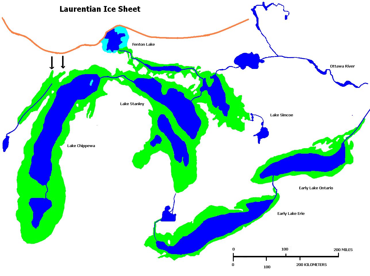
This map was the work of wikimedia contributor Chris Light who released it under the Creative Commons Attribution-Share Alike 3.0 Unported license, on 2014-06-24
Their original caption read:
- Glacial Lakes Chippewa, Stanley, Early Erie and Early Ontario. Low level lake stages during the end of the Wisconsin Glacial era in North America. Based on Larsen map, 1987.
File history
Click on a date/time to view the file as it appeared at that time.
| Date/Time | Thumbnail | Dimensions | User | Comment | |
|---|---|---|---|---|---|
| current | 21:02, 24 November 2019 | | 1,287 × 961 (125 KB) | Geo Swan (Talk | contribs) | This map was the work of wikimedia contributor [https://commons.wikimedia.org/wiki/User:Chris_Light Chris Light] who released it under the [https://creativecommons.org/licenses/by-sa/3.0/deed.en Creative Commons Attribution-Share Alike 3.0 Unported] l... |
- You cannot overwrite this file.
File usage
The following page links to this file:
.jpg&oldid=205966)
.jpg)
.jpg&action=edit&redlink=1)
.jpg&action=edit)
.jpg&action=history)
.jpg)
.jpg)
.jpg&oldid=205966&printable=yes)
.jpg&oldid=205966)
.jpg&action=info)